Region:
Klondike
Site description:
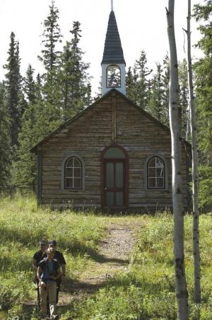
- Cultural heritage site co-owned and co-managed by the Selkirk First Nation and Government of Yukon.
- Designated a Yukon Territorial Heritage Site in 2010.
- Interpreters provide guided tours of the 1852 settlement.
- Popular with canoeists.
- You don't need a camping permit, but we encourage visitors to sign the register at the Interpreters’ Stone House.

Location
GPS coordinates:
62.774°N 137.386°W
Site directions:
Confluence of the Yukon and Pelly rivers.
Services available
Outhouse unisex
Bear proof garbage bins
Blue bear-proof recycling bins
Picnic tables
Cook shelter
Fire ring
Boat launch
Hiking trails
Hand pump or water tank provided
Viewing structures or signage about local cultural and natural history
Group campsite
Tent pads or sites available via walking trail