Region:
North Yukon
Registration required:
Yes
Total sites:
11
Pull through:
0
Serviced:
May 17 to September 30, 2024
Gate open:
May 17 to September 30, 2024
Site description:
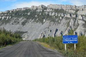
- Lies below Sapper Hill, a collection of dolomite cliffs. The route to the cliffs is a popular day hike.
- Sapper is the nickname for army engineers and the hill is named in honour of the Third Royal Canadian Army Engineers who constructed the Ogilvie Bridge.
- The Gwich'in name Chü Akan means "beaver house mountain." It refers to a story about ancient giant beavers in the area.
- The creek's Gwich'in name, Chuu Ts'ann Njik, means "smelly water creek."
- You can often see peregrine falcons and golden eagles at the cliffs.
Campground peak times:
May
June
July
August
September

Location
Highway:
Dempster Highway
Highway kilometre:
193.0
GPS coordinates:
65.3523°N 138.27186°W
Map download:
Engineer Creek Campground map (218.12 KB)
Services available
Outhouse unisex
Bear proof garbage bins
Blue bear-proof recycling bins
Picnic tables
Cook shelter
Fire ring
Bear proof cache
Hiking trails
Viewing structures or signage about local cultural and natural history