Region:
Klondike
Serviced:
May 17 to September 30, 2024
Gate open:
Gate open year-round
Warning:
Though it is a manufactured staircase you are still in the wilderness. Carry bear spray on your walk to the rapids.
Site description:
- Good place to stretch your legs while driving the North Klondike Highway.
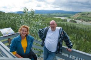
- Features a viewing platform, 219-step staircase and trail with interpretive panels.
- The name comes from the 4 islands that split the river into 5 channels.
- The rapids were a danger for gold seekers during the Klondike Gold Rush.
- In the 1900s, explosives were used to widen this channel.

Location
Highway:
Klondike Highway
Highway kilometre:
380.0
Secondary road kilometre:
0.0
GPS coordinates:
62.27345°N 136.34254°W
Map download:
Five Finger Rapids Recreation Site map (2.78 MB)
Services available
Outhouse unisex
Bear proof garbage bins
Picnic tables
Hiking trails
At least one wheelchair accessible outhouse
Viewing structures or signage about local cultural and natural history