Region:
Klondike
Registration required:
Yes
Total sites:
35
Pull through:
2
Serviced:
May 3 to September 30, 2024
Gate open:
May 3 to September 30, 2024
Site description:
- 20 km outside Dawson City.
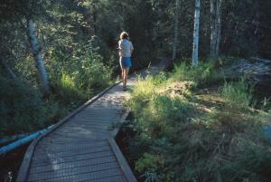
- Has a 1.7 km interpretive trail and boardwalk to the Klondike River through old-growth forest that wasn’t dredged or cut during the Gold Rush.
- The Hän name for the river, Tr'ondëk, refers to the hammer rock used to drive salmon weir stakes into the mouth of the river.
- There is a rich variety of plant life in the area.
Campground peak times:
May
June
July
August
September

Location
Highway:
Klondike Highway
Highway kilometre:
697.0
GPS coordinates:
64.04979°N 139.11329°W
Map download:
Klondike River Campground map (320.87 KB)
Services available
Outhouse unisex
Bear proof garbage bins
Blue bear-proof recycling bins
Picnic tables
Cook shelter
Fire ring
Bear proof cache
Hiking trails
Playground
At least one wheelchair accessible outhouse
At least one wheelchair accessible campsite
Hand pump or water tank provided
Viewing structures or signage about local cultural and natural history