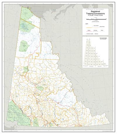
A Registered Trapping Concession (RTC) is a legal boundary of an area. The holder of a concession has the exclusive right to trap fur-bearing animals within it. Trapping mostly occurs along waterways. A concession is often defined by watersheds, using ridges and mountain peaks as boundaries. This is distinct from Game Management Areas (GMA), which are defined by mountain blocks.
Sometimes RTCs are grouped together to form a group trapping concession. This means a group has the right to trap in the area. When a group concession is created, individual RTC boundaries may be removed.
The Yukon has 360 RTCs and 13 group trapping concessions. Kluane National Park and Reserve, Kluane Wildlife Sanctuary, and Ddhaw Gro Habitat Protection Area do not have any RTCs.
RTCs are legally defined by the 1:250,000 scale map series ENV.RTC.
These data are available at nominal scales of 1:250,000 and 1:1,000,000.
- View PDF maps of registered trapping concessions generated from these data.
- Preview and download via ArcGIS Hub with the option of alternate output formats.
- Directly download in shape, file geodatabase and KML formats.
For questions about Registered Trapping Concession map data, email env-gis-unit@yukon.ca.